
Geodynamic monitoring tracks slow movements of the ground and structures over time, so problems are caught while they are still small.
What we do
We set up permanent or temporary monitoring networks, measure them at agreed intervals, and report displacement against the baseline and the alert thresholds set in the project.
- Ground settlement and heave monitoring
- Displacement of slopes, embankments and dam structures
- Monitoring of buildings and nearby infrastructure during excavation
- Tilt and crack monitoring of structures
Methods and equipment
- Permanent GNSS stations with continuous recording
- Precise levelling of benchmarks
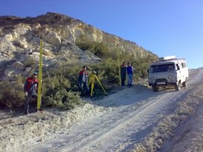
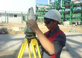
- Robotic total stations for automatic prism monitoring
- Crack gauges and tiltmeters on structures
Deliverables
- Baseline survey report
- Periodic measurement reports with graphs
- Alert notice when a threshold is reached
- Data access online or in shared files
Typical timeline
Setting up the baseline network takes 1 to 2 weeks. Monitoring then runs for the agreed period, usually several months during construction and longer for operating facilities.
Request a quote
Send us the site location, the area and the deadline, and we will reply with a quote for your project.
Request a quote