
Construction geodesy keeps a project in the right place. We set out the design geometry on the ground, check the position and level of every element as it is built, and document the result.
What we do
We transfer design coordinates from the drawings to the site, check that works stay within tolerance, and prepare as-built surveys for handover and acceptance.
- Setting out of buildings, roads, pipelines and utility networks
- Control of foundations, columns and other structural elements during construction
- Monitoring of settlement and displacement of structures
- As-built surveys and volume calculations for acceptance
Methods and equipment
- Robotic total stations for setting out
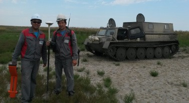
- RTK GNSS for road and pipeline alignments
- Digital levels for height transfer
- Check measurements against design tolerances, recorded per element
Deliverables
- Setting-out protocol with the list of control points
- As-built survey drawings
- Settlement and displacement log
- Volume calculation statement
Typical timeline
Setting out a typical building takes 1 to 2 days once the control network is in place. Long linear projects are set out section by section, usually in weekly batches.
Request a quote
Send us the site location, the area and the deadline, and we will reply with a quote for your project.
Request a quote